00issue 01
Development Passport.
One record of the site and its scheme: the evidence, the design, the numbers and the next decision.
- 412homes
- £96.4mcost
- ✓all checks
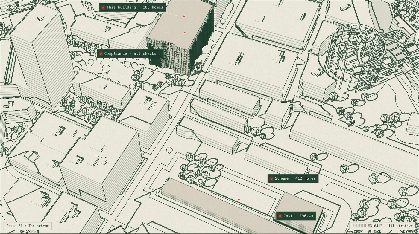
Issue 01 / The schemeMX-0412 · illustrative
Contents
01what's inside
Everything the next decision needs.
Six parts, each traced to its sources and kept current as the scheme changes. And everything it makes, next.
- #1
Site evidence
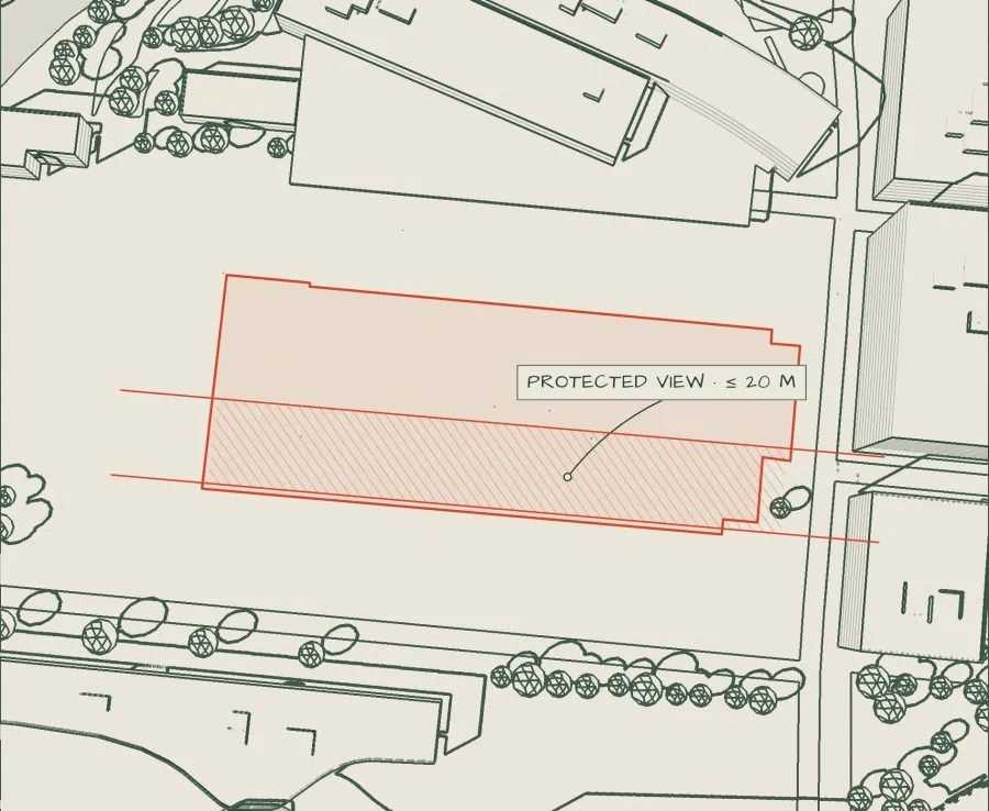
Ownership, flood risk, history, heritage, access and ground, read from live sources before anything is drawn.
5 known · 1 assumed · 1 missing
- #2
Planning position
The policies that apply, the uses and heights they allow, and how the scheme answers each one.
Mixed use · ≤ 30 m · protected view
- #3
Masterplan
The scenarios tested on the site, the one taken forward and the massing behind it.
3 scenarios · 412 homes
- #4
Compliance record
Every standard checked, where and against what: space standards, daylight, fire and access.
All checks ✓ · traceable
- #5
Financials
Quantities, values, costs and residual land value, tied to the coordinated design.
£96.4m cost · −2 % this issue
- #6
Technical packages
Core, floor plans, daylight, airflow and services, drawn on the same model by the specialists.
5 studies per building
What you get
02every output
Every output. From one model.
A one-to-one digital twin of the scheme, and everything it makes: explore it, walk every home, watch it run, sell it. Every image, film and number comes from the same model, so they all agree, and they all update when the design does.
Illustrative outputs of a fictional scheme. Drag to look through them, or pick a group.
The scheme
03one model
Every layer. One model.
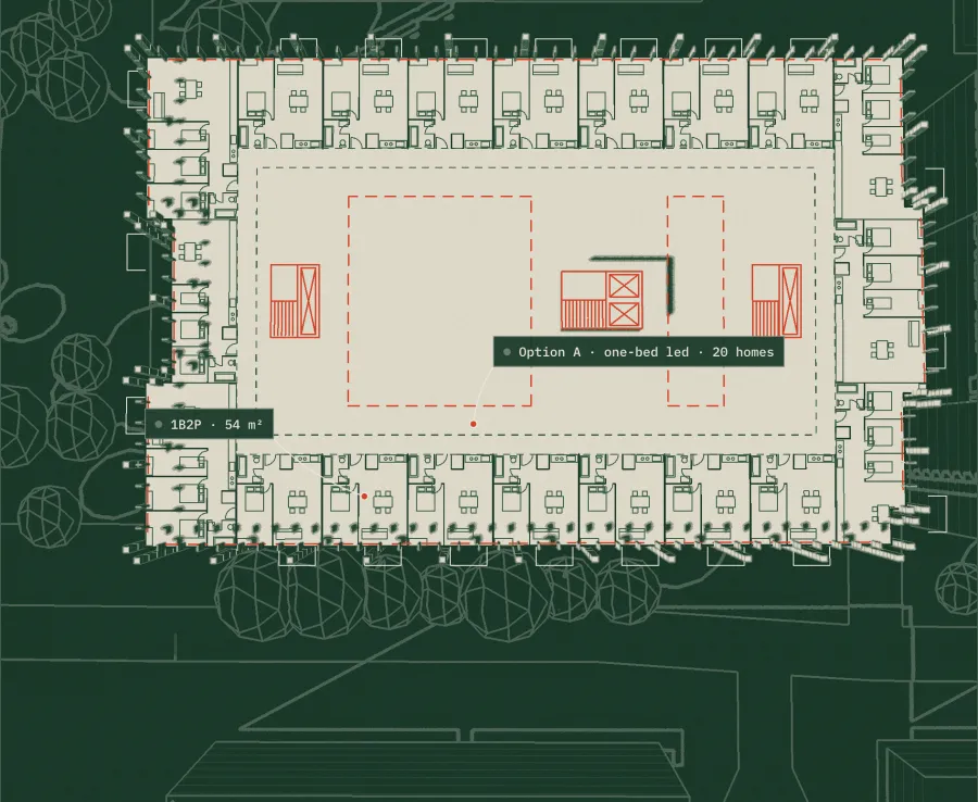
The land, the plans, the daylight, the air and the services, all drawn on the model the numbers come from.
- The land
- Floor plans
- Daylight
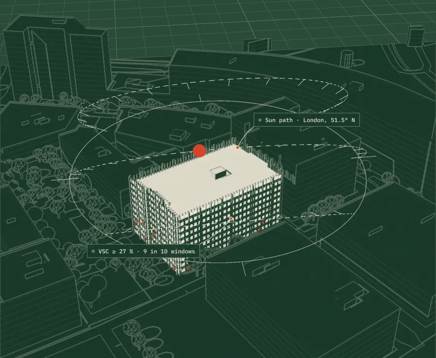
- Airflow
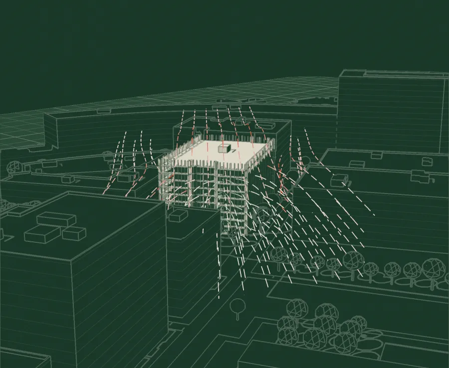
- Energy
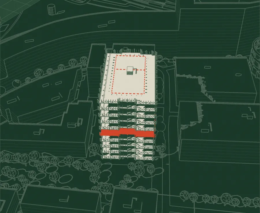
- The scheme
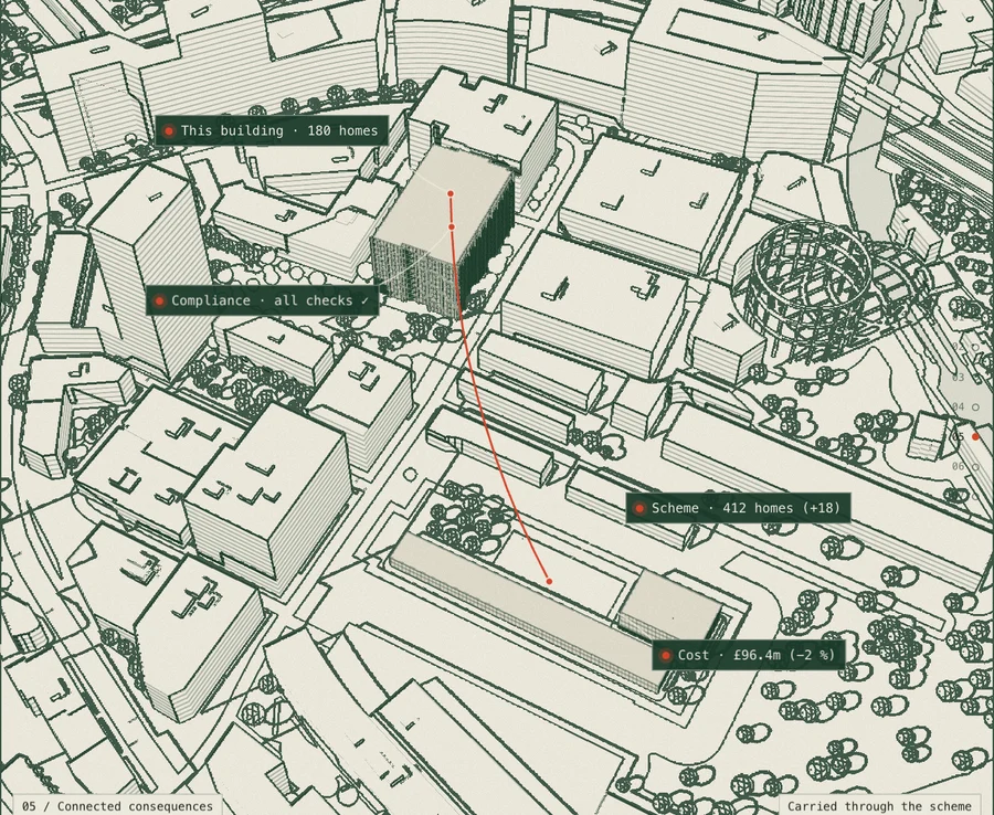
Illustrative model of a fictional district. A visualisation, not a survey.
The numbers
04scenarios tested
Three scenarios tested. One taken forward.
-
01 · C3 + E
Residential-led
Homes over ground-floor shops
- 64 homes
- 1,100 m² commercial
- Residual land value £3.1m
- Daylight to 8 in 10 homes
-
03 · F1 + F2 · taken forward
Civic and community
A library and hall, homes above
- 2,900 m² civic and community
- 38 homes above
- Residual land value £1.9m
- Strongest planning case
-
02 · E(g)
Commercial-led
Workspace around a yard
- 5,600 m² workspace
- About 430 jobs
- Residual land value £2.4m
- Needs a pre-let to start
Illustrative figures for a fictional site. Use classes as the Use Classes Order (England). Planning decisions remain with the relevant authority.
Track record
05project evidence
Crompton Place, Bolton
Less build area. Same development output.
- 247 homes retained
- ~1,500 m² less build area
- ~£4m estimated cost reduction
Modelled findings, not realised savings.
FAQs
Is the passport a planning application?
No. It holds the evidence and the scheme behind one, set out so the design team, the planners and the authority can review the same picture. Statutory approvals and professional sign-off stay with the relevant authority and the appointed professionals.
Who is it for?
Landowners, developers, funders, planners and the design team: anyone who needs the same picture of the site before the next decision.
How does it stay current?
It is drawn from the living model. When the design changes, the homes, cost, daylight and compliance figures change with it, and each change is recorded with what it affected.
Where does the evidence come from?
Public data (HM Land Registry, the Environment Agency, Historic England, Ordnance Survey and the local plan) and the specialists working on the scheme. Every figure shows its source and whether it is known, assumed or missing.
What happens after RIBA 2?
The passport carries on through technical design and construction to an in-use record at RIBA 7, so the building's performance can be checked against what was planned. Scope and live-data services are agreed per project.
Start yours
07your site could be next
Bring us a site. We'll start its passport.
Share an address or a boundary. We'll read the land and tell you what it could support.
- Site evidence
- Planning position
- Masterplan
- Compliance record
- Financials
- Technical packages