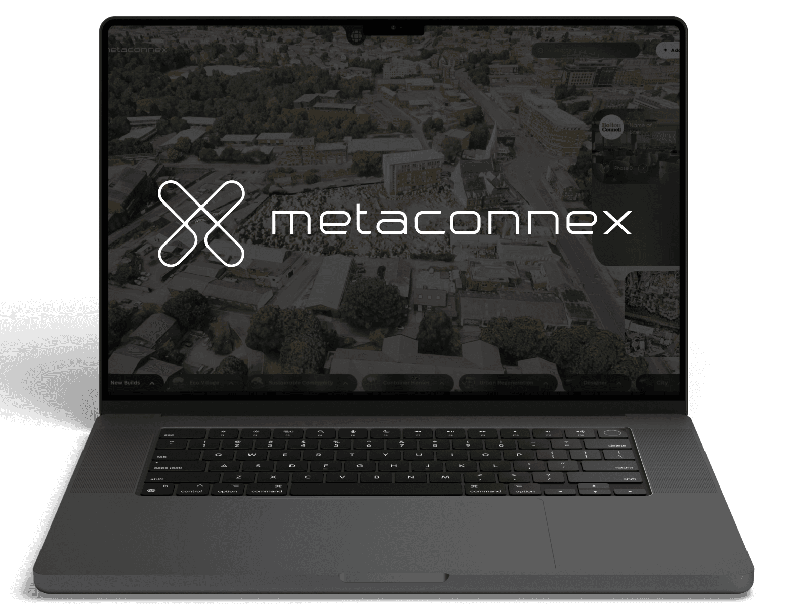
Introducing the world's first place planning and finance platform.
Introducing the world's first place planning and finance platform.
Watch the video
Watch the video
Watch the video

The future of the UK Planning System.
The future of the UK Planning System.
The new Labour government is set to “get Britain building again” aiming to build 1.5 million homes over the next parliament implementing a "once in a generation" overhaul of the National Policy Planning Framework.
Beyond housing, reforms will prioritise brownfield sites, green belt access, and new Compulsory Purchase Orders.
MetaConnex™ plays a crucial role in this initiative by unlocking capabilities at pace, significantly accelerating the planning and construction process.


Mandatory Housing Targets
1.5M HOMES
Mandatory Housing Targets
1.5M HOMES

Brownfield prioritisation
11,205 SITES
Brownfield prioritisation
11,205 SITES

Cross-boundary strategic planning
48 COUNTIES
Cross-boundary strategic planning
48 COUNTIES

Additional Planning Officers
+300 Hires
Additional Planning Officers
+300 Hires

The Fragmented Planning System
Effective and sustainable development requires cooperation among local authorities, developers, and investors. However, fragmented tools and relationships hinder the planning process. A unified platform could enhance collaboration, streamline operations, and lead to more efficient, cost-effective projects.
Introducing, MetaConnex™
Introducing, MetaConnex™
MetaConnex™ is a global master-planning platform that creates digital twins to visualise, conceptualise, place-make, model, and appraise sites using data. By fostering synergy among stakeholders, MetaConnex™ significantly reduces the timeframe from planning to construction, enabling more efficient and effective development and
investment.

How traditional
dev flow works
18 months
Land
Plan
Design
Finance
Construction
Sales
How MetaConnex™ dev flow works
How MetaConnex™
dev flow works
How MetaConnex™
dev flow works
3 months
Sales
Sales
Construction
Construction
Design
Design
Finance
Finance
Cost
Cost
Land
Land
Visual Planning and Placemaking
Visual Planning and Placemaking
Development & Construction
Development & Construction
Finance and Investment
Finance and Investment
Finance and Investment

The data sources we pull from
The data sources we pull from


Land Registry
Access land and property data. dasdsadas
Data Point 1
Ownership
Data Point 2
Boundaries
Data Point 3
Transaction History
Land Registry
Access land and property data. dasdsadas
Data Point 1
Ownership
Data Point 2
Boundaries
Data Point 3
Transaction History
Land Registry
Access land and property data. dasdsadas
Data Point 1
Ownership
Data Point 2
Boundaries
Data Point 3
Transaction History
Land Registry
Access land and property data. dasdsadas
Data Point 1
Ownership
Data Point 2
Boundaries
Data Point 3
Transaction History

Land
Heritage
Comprehensive insight into past land usage for research, planning and preservation.
Data Point 1
Cultural Landmarks
Data Point 2
Heritage Sites
Data Point 3
Historical Land Use
Land
Heritage
Comprehensive insight into past land usage for research, planning and preservation.
Data Point 1
Cultural Landmarks
Data Point 2
Heritage Sites
Data Point 3
Historical Land Use
Land
Heritage
Comprehensive insight into past land usage for research, planning and preservation.
Data Point 1
Cultural Landmarks
Data Point 2
Heritage Sites
Data Point 3
Historical Land Use
Land
Heritage
Comprehensive insight into past land usage for research, planning and preservation.
Data Point 1
Cultural Landmarks
Data Point 2
Heritage Sites
Data Point 3
Historical Land Use

Office for
National Statistics
Wide range of socio-economic data for analysis and reporting purposes
Data Point 1
Economy
Data Point 2
Population
Data Point 3
Public Health
Office for
National Statistics
Wide range of socio-economic data for analysis and reporting purposes
Data Point 1
Economy
Data Point 2
Population
Data Point 3
Public Health
Office for
National Statistics
Wide range of socio-economic data for analysis and reporting purposes
Data Point 1
Economy
Data Point 2
Population
Data Point 3
Public Health
Office for
National Statistics
Wide range of socio-economic data for analysis and reporting purposes
Data Point 1
Economy
Data Point 2
Population
Data Point 3
Public Health

OS Maps
Integrate detailed mapping data into planning applications.
Data Point 1
Location based services
Data Point 2
Geospatial data
Data Point 3
Boundary Lines
OS Maps
Integrate detailed mapping data into planning applications.
Data Point 1
Location based services
Data Point 2
Geospatial data
Data Point 3
Boundary Lines
OS Maps
Integrate detailed mapping data into planning applications.
Data Point 1
Location based services
Data Point 2
Geospatial data
Data Point 3
Boundary Lines
OS Maps
Integrate detailed mapping data into planning applications.
Data Point 1
Location based services
Data Point 2
Geospatial data
Data Point 3
Boundary Lines

Office for
National Statistics
Wide range of socio-economic data for analysis and reporting purposes
Data Point 1
Economy
Data Point 2
Population
Data Point 3
Public Health
Office for
National Statistics
Wide range of socio-economic data for analysis and reporting purposes
Data Point 1
Economy
Data Point 2
Population
Data Point 3
Public Health
Office for
National Statistics
Wide range of socio-economic data for analysis and reporting purposes
Data Point 1
Economy
Data Point 2
Population
Data Point 3
Public Health
Office for
National Statistics
Wide range of socio-economic data for analysis and reporting purposes
Data Point 1
Economy
Data Point 2
Population
Data Point 3
Public Health

MET
Office
Access real time weather data and forecasting from the UK Met Ofiice.
Data Point 1
Weather Conditions
Data Point 2
Predictive Forecasting
Data Point 3
Historical Weather Data
MET
Office
Access real time weather data and forecasting from the UK Met Ofiice.
Data Point 1
Weather Conditions
Data Point 2
Predictive Forecasting
Data Point 3
Historical Weather Data
MET
Office
Access real time weather data and forecasting from the UK Met Ofiice.
Data Point 1
Weather Conditions
Data Point 2
Predictive Forecasting
Data Point 3
Historical Weather Data
MET
Office
Access real time weather data and forecasting from the UK Met Ofiice.
Data Point 1
Weather Conditions
Data Point 2
Predictive Forecasting
Data Point 3
Historical Weather Data

Department for
transport
Complete statistical data for UK transportation networks.
Data Point 1
Public Transit
Data Point 2
Road Networks
Data Point 3
Traffic Conditions
Department for
transport
Complete statistical data for UK transportation networks.
Data Point 1
Public Transit
Data Point 2
Road Networks
Data Point 3
Traffic Conditions
Department for
transport
Complete statistical data for UK transportation networks.
Data Point 1
Public Transit
Data Point 2
Road Networks
Data Point 3
Traffic Conditions
Department for
transport
Complete statistical data for UK transportation networks.
Data Point 1
Public Transit
Data Point 2
Road Networks
Data Point 3
Traffic Conditions

Department for environment
Comprehensive environmental data to aid research, planning and management
Data Point 1
Air & Water Quality
Data Point 2
Conservation Efforts
Data Point 3
Wildlife
Department for environment
Comprehensive environmental data to aid research, planning and management
Data Point 1
Air & Water Quality
Data Point 2
Conservation Efforts
Data Point 3
Wildlife
Department for environment
Comprehensive environmental data to aid research, planning and management
Data Point 1
Air & Water Quality
Data Point 2
Conservation Efforts
Data Point 3
Wildlife
Department for environment
Comprehensive environmental data to aid research, planning and management
Data Point 1
Air & Water Quality
Data Point 2
Conservation Efforts
Data Point 3
Wildlife
HOW
METACONNEX
WORKS


{ Step 1 }
{ Step 1 }
MetaConnex™ integrates multiple layers of data to create a digital twin of any town or city on Earth.
MetaConnex™ integrates multiple layers of data to create a digital twin of any town or city on Earth.
We unlock data-driven decision-making and stakeholder collaboration, leading to improved accuracy, efficiency, and
streamlined processes.
We unlock data-driven decision-making and stakeholder collaboration, leading to improved accuracy, efficiency, and streamlined processes.

Develop
Digital Twin

Data Collection
Data Collection
Data Integration
Data Integration
Data Analysis
Data Analysis
Synchronization
Synchronization
Visualization
Visualization
{ Step 2 }
{ Step 2 }
MetaConnex™ creates a development plan by integrating the Local Plan and supplementary planning documents
MetaConnex™ creates a development plan by integrating the Local Plan and supplementary planning documents
This effectively guides land use, zoning, infrastructure development, community engagement, and policy implementation.
This effectively guides land use, zoning, infrastructure development, community engagement, and policy implementation.
Local Plan
Authority Monitoring
Report
Area Action
Plans
Local Development Scheme
Neighbourhood
Plans
Infrastructure Delivery Plan
Supplementary Planning Documents
Statement of Community Involvement

Formulate
Development
Plan

Create
Policy Map
{ Step 3 }
{ Step 3 }
MetaConnex™ visually illustrates spatial policies, zoning, development boundaries and constraints in a comprehensive policy map.
MetaConnex™ visually illustrates spatial policies, zoning, development boundaries and constraints in a comprehensive policy map.
This map clearly displays land use regulations, facilitating informed decisions and enhancing public engagement.
This map clearly displays land use regulations, facilitating informed decisions and enhancing public engagement.
Zoning Boundaries
Zoning
Boundaries
Zoning
Boundaries
Protected
Areas
Protected
Areas
Protected
Areas
Transportation Corridors
Transportation Corridors
Transportation Corridors
Environmental Constraints
Environmental Constraints
Environmental Constraints
Land Use Designations
Land Use Designations
Land Use Designations
Development Areas
Development Areas
Development Areas
Infrastructure Networks
Infrastructure Networks
Infrastructure Networks
Community Facilities
Community Facilities
Community Facilities

Evaluate
Land Ownership
Evaluate
Land Ownership
{ Step 4 }
{ Step 4 }
MetaConnex™ automatically analyses official records of
land and property ownership
MetaConnex™ automatically analyses official records of
land and property ownership
This process ensures transparent property transactions and smooth dispute resolution all while supporting stable economic growth.
This process ensures transparent property transactions and smooth dispute resolution all while supporting stable economic growth.
{ Step 5 }
{ Step 5 }
Harness MetaConnex™ to set clear objectives, establish KPIs, and align with long-term community needs and strategic goals.
Harness MetaConnex™ to set clear objectives, establish KPIs, and align with long-term community needs and strategic goals.
Create a development framework to
Create a development framework to

Establish
Development
Framework
Establish
Development
Framework
development
framework
development
framework
development
framework
Social
Dimension
Social
Dimension
Social
Dimension
Economic
Dimension
Economic
Dimension
Economic
Dimension
Environmental
dimension
Environmental
dimension
Environmental
dimension
Smart
Transport
Smart
Transport
Smart
Transport
Smart
Infrastructure
Smart
Infrastructure
Smart
Infrastructure
Smart
Environment
Smart
Environment
Smart
Environment
Smart
Energy
Smart
Energy
Smart
Energy
Smart
Safety
Smart
Safety
Smart
Safety
Smart
Healthcare
Smart
Healthcare
Smart
Healthcare
Smart
Planning
Smart
Planning
Smart
Planning
Smart Waste
Management
Smart Waste
Management
Smart Waste
Management
People's
Participation
People's
Participation
People's
Participation
Smart
Traffic
Smart
Traffic
Smart
Traffic

Evaluate
Land Ownership
Evaluate
Land Ownership
{ Step 6 }
{ Step 6 }
MetaConnex™ visually illustrates spatial policies, zoning Meta-Process Model
MetaConnex™ visually illustrates spatial policies, zoning Meta-Process Model
Integrate geospatial information, infrastructure planning, and economic and environmental factors into a unified digital platform. Using GIS, BIM, and IoT, it creates detailed 3D and 4D models for interactive simulations and real-time analytics.
Integrate geospatial information, infrastructure planning, and economic and environmental factors into a unified digital platform. Using GIS, BIM, and IoT, it creates detailed 3D and 4D models for interactive simulations and real-time analytics.
1
Unified Data Model
Unified Data Model
Unified Data Model
integration and standardisation of data
integration and standardisation of data
integration and standardisation of data
2
Digital Twin
Digital Twin
Digital Twin
dynamic interactive virtual representation of physical assets
dynamic interactive virtual representation of physical assets
dynamic interactive virtual representation of physical assets
3
Digital Model
Digital Model
Digital Model
masterplan development strategy and urban planning
masterplan development strategy and urban planning
masterplan development strategy and urban planning
4
Dynamic Appraisal
Dynamic Appraisal
Dynamic Appraisal
link to digital development model
link to digital development model
link to digital development model
5
Simulation
Simulation
Simulation
visualise development scenarios and outcomes
visualise development scenarios and outcomes
visualise development scenarios and outcomes
6
Prospectus
identify investment opportunities and cost-benefit predictions
7
Engagement
demonstrate viability and deliverability
8
Planning
expedite approvals and demonstrate regulatory alignment
9
Implementation
investment secured, and approvals obtained
9
Implementation
Implementation
investment secured, and approvals obtained
investment secured, and approvals obtained
8
Planning
Planning
expedite approvals and demonstrate regulatory alignment
expedite approvals and demonstrate regulatory alignment
7
Engagement
Engagement
demonstrate viability and deliverability
demonstrate viability and deliverability
6
Prospectus
Prospectus
identify investment opportunities and cost-benefit predictions
identify investment opportunities and cost-benefit predictions

Conduct Dynamic
Development
Appraisal
Conduct Dynamic
Development
Appraisal
{ Step 7 }
{ Step 7 }
MetaConnex™ enables Dynamic Development Appraisals to conduct real-time financial feasibility assessments.
MetaConnex™ enables Dynamic Development Appraisals to conduct real-time financial feasibility assessments.
Every modification is automatically updated to manage risks and strategically plan, ensuring efficient resource allocation and cost control throughout all development phases.
Every modification is automatically updated to manage risks and strategically plan, ensuring efficient resource allocation and cost control throughout all development phases.

Craft
Prospectus
{ Step 8 }
{ Step 8 }
MetaConnex™ configures a interactive prospectus to inform and attract potential investors
MetaConnex™ configures a interactive prospectus to inform and attract potential investors
How casing immersive site visualizations with comprehensive project details and financial projections offers complete transparency to stakeholders. Use it as a marketing tool to engage investors, facilitate informed investment decisions, and enhance project credibility.
How casing immersive site visualizations with comprehensive project details and financial projections offers complete transparency to stakeholders. Use it as a marketing tool to engage investors, facilitate informed investment decisions, and enhance project credibility.

Submit
Planning
{ Step 9 }
{ Step 9 }
MetaConnex™ then encapsulates into a planning application
MetaConnex™ then encapsulates into a planning application
Every modification is automatically updated to manage risks and strategically plan, ensuring efficient resource allocation and cost control throughout all development phases.
Every modification is automatically updated to manage risks and strategically plan, ensuring efficient resource allocation and cost control throughout all development phases.
{ Step 10 }
{ Step 10 }
Export your compiled information ready to send
directly to partners.
Export your compiled information ready to send
directly to partners.
MetaConnex™ ensures seamless and efficient communication across all stakeholders, both on and off the platform. Streamline your processes using the tool, then export data in the required format and context for every stage of the workflow.
MetaConnex™ ensures seamless and efficient communication across all stakeholders, both on and off the platform. Streamline your processes using the tool, then export data in the required format and context for every stage of the workflow.
Export
Prospectus
Develop
Digital Twin
Develop
Digital Twin
Develop
Digital Twin
Submit
Planning
Submit
Planning
Submit
Planning
Formulate
Development
Plan
Formulate
Development
Plan
Formulate
Development
Plan
Craft
Prospectus
Craft
Prospectus
Craft
Prospectus
Create
Policy Map
Create
Policy Map
Create
Policy Map
Conduct Dynamic
Development
Appraisal
Conduct Dynamic
Development
Appraisal
Conduct Dynamic
Development
Appraisal
Evaluate
Land Ownership
Evaluate
Land Ownership
Evaluate
Land Ownership
Establish
Development
Framework
Establish
Development
Framework
Establish
Development
Framework
Design Digital
Urban Development Masterplan
Design Digital
Urban Development Masterplan
Design Digital
Urban Development Masterplan


1 Platform, 3 Key Stakeholders
1 Platform, 3 Key Stakeholders
Streamlining processes and fostering collaboration among stakeholders is a key principle that make MetaConnex™ so powerful. Discover how the platform caters to the unique needs of each user, highlighting the key benefits it provides.
Streamlining processes and fostering collaboration among stakeholders is a key principle that make MetaConnex™ so powerful. Discover how the platform caters to the unique needs of each user, highlighting the key benefits it provides.

Local Authority
MetaConnex™ is free to use for local authorities, empowering them to viably appraise sites and submit planning applications in record time without ever having to leave the platform.


Developers
MetaConnex™ revolutionises the planning system for developers by providing an integrated platform that simplifies and accelerates the entire development process

Investors
MetaConnex™ offers a comprehensive and transparent platform that minimides risks and maximides returns by providing detailed insights, streamlined planning, and secure procurement processes to ensure successful project outcomes.
OUR
CASE
STUDIES
Partnering with Bolton City to placemake and masterplan their innovative “Bolton 2040 vision”
Partnering with Bolton City to placemake and masterplan their innovative “Bolton 2040 vision”


Bolton's Path to a Vibrant Future
Bolton's Path to a Vibrant Future
MetaConnex™ has proven its ability to drive urban regeneration, save time and money, and support ambitious development visions, positioning Bolton for a vibrant and prosperous future.
MetaConnex™ has proven its ability to drive urban regeneration, save time and money, and support ambitious development visions, positioning Bolton for a vibrant and prosperous future.
Watch the video
Watch the video
Watch the video
Watch the video

Bolton is striving to bring investors to the city across numerous sites and MetaConnex™ is the key to drive that intervention forward.
It’s a unique tool that makes all the difference - it truly helps us to sell everything that’s happening in Bolton.
Bolton is striving to bring investors to the city across numerous sites and MetaConnex™ is the key to drive that intervention forward.
It’s a unique tool that makes all the difference - it truly helps us to sell everything that’s happening in Bolton.
Bolton is striving to bring investors to the city across numerous sites and MetaConnex™ is the key to drive that intervention forward.
It’s a unique tool that makes all the difference - it truly helps us to sell everything that’s happening in Bolton.
Paul Whittingham
Paul Whittingham
Paul Whittingham
Assistant Director of Development & Regeneration
Assistant Director of Development & Regeneration
Assistant Director of Development & Regeneration
Bolton Council
Bolton Council
Bolton Council
Unique benefits for stakeholders
Unique benefits for stakeholders
MetaConnex™ connects stakeholders in an all-in-one platform, offering unique benefits
for local authorities, developers, and investors
MetaConnex™ connects stakeholders in an all-in-one platform, offering unique benefits
for local authorities, developers, and investors
Company
Company
Company
Company
Dimensions
Dimensions
Dimensions
Dimensions
APi’s Integrations
APi’s Integrations
APi’s Integrations
APi’s Integrations
3D Modelling/ Massing
3D Modelling/ Massing
3D Modelling/ Massing
3D Modelling/ Massing
Collaboration/ Communication
Collaboration/ Communication
Collaboration/ Communication
Collaboration/ Communication
Live Data Modelling (Economic, Environmental, Social)
Live Data Modelling (Economic, Environmental, Social)
Live Data Modelling (Economic, Environmental, Social)
Live Data Modelling (Economic, Environmental, Social)
BIM integration
BIM integration
BIM integration
BIM integration
Cost
Cost
Cost
Cost

Land Insight
Land Insight
Land Insight
Land Insight
2D
2D
2D
2D
£299
£299
£299
£299

Google Earth
Google Earth
Google Earth
Google Earth
3D
3D
3D
3D
Free
Free
Free
Free

Planning Portal
Planning Portal
Planning Portal
Planning Portal
2D
2D
2D
2D
Undisclosed
Undisclosed
Undisclosed
Undisclosed

Vue City
Vue City
Vue City
Vue City
3D/4D
3D/4D
3D/4D
3D/4D
Project by Project
Project by Project
Project by Project
Project by Project

MetaConnex™
MetaConnex™
MetaConnex™
MetaConnex™
3D/4D
3D/4D
3D/4D
3D/4D
Free to la
Free to la
Free to la
Free to la
OUR
Team
OUR
Partners

The Planning Portal is a website for submitting planning applications and finding planning guidance. It is owned by TerraQuest Solutions Limited. Planning Portal that was established by UK Government in 2002 to allow planning applications in England and Wales to be processed electronically.
Planning Portal
Planning Technoloy

Sir Robert McAlpine Limited is a family-owned building and civil engineering company based in Hemel Hempstead, England. It carries out engineering and construction in the infrastructure, heritage, commercial, arena and stadium, healthcare, education and nuclear sectors.
Sir Robert McAlpine
Building Company

Embarking on a transformative journey, Bolton is home to our first pilot regeneration project. Partnering with the city council we are ushering in a new era of innovation and community, redefining the town's landscape and elevating the local economy to new heights.
Bolton City Council
Pilot Project
The Planning Portal is a website for submitting planning applications and finding planning guidance. It is owned by TerraQuest Solutions Limited. Planning Portal that was established by UK Government in 2002 to allow planning applications in England and Wales to be processed electronically.
Planning Portal
Planning Technoloy
Sir Robert McAlpine Limited is a family-owned building and civil engineering company based in Hemel Hempstead, England. It carries out engineering and construction in the infrastructure, heritage, commercial, arena and stadium, healthcare, education and nuclear sectors.
Sir Robert McAlpine
Building Company
Embarking on a transformative journey, Bolton is home to our first pilot regeneration project. Partnering with the city council we are ushering in a new era of innovation and community, redefining the town's landscape and elevating the local economy to new heights.
Bolton City Council
Pilot Project

Executive Leadership


Joseph Michael Daniels
Group CEO & Founder
World-leading Tech and Net-Zero Entrepreneur | Chair of Decarbonisation UK Business Council for Sustainable Development | Forbes 30u30 | UN75


Catalina Valentino
COO (Interim)
Tech & VC Entrepreneur | Special Advisor UK Business Council for Sustainable Development | Partner at Una Terra Impact Fund | Forbes Business Council
Management Team


Ashley Dunseath
MD of Placemaking
Ex-Head of Development Advisory at WSP in UK | Previous Equity Partner & Board Member of LDA Design | MD for UK Business Council for Sustainable Development

Paul Sweeting
CHIEF OPERATING OFFICER (Interim)
Senior Advisor at Hassana Investment Company | Previously Governor Assistant for Financial Sustainability and Risk Management at GOSI | Hassana's Chief Risk Officer | Professor of Actuarial Science at the University of Kent, where I remain an Honorary Professor. | Author of "Financial Enterprise Risk Management.

Shamir Ghumra
Managing Director of Sustainability
Director of Responsible Business NHS Property Services | Ex-head of Building Performance Services at BRE (Building Research Establishment). World leading expert on sustainability challenges in the built environment | Engineering Doctorate from Loughborough University | Fellow of the Institute of Environmental Management and Assessment (IEMA) and a Chartered Environmentalist | Visiting Professor of ESG Performance and Strategy at Loughborough University and is a board member of the IEMA.
Tech Team


Danyl Goodall
CHIEF XPERIENCE OFFICER
User Experience & Interaction Expert |
Led the product design & articulation of multiple successful products in the digital twin and urban development sector |
Data visualisation specialist


Luke Anderton
Chief Creative Technologist
Founded the leading gaming engine training academy on YouTube before founding Virtus Studios in 2022 (200k+ subscribers) | Leading developer through Virtus Studios | Specialises in real-world applications of gaming engine and digital twin technology.

Uros Jovanovic
Chief Data ArchiteCt
Software Architect & Full Stack Developer | 10+ years experience working with big data across legacy systems and emerging technology for technologies innumerous industry verticals |
Special Advisors

James Mcintyre
USA Advisor
Chief Strategy Officer at Inclusive Prosperity Capital (IPC)
Focuses on clean energy for underserved communities
Directed Capital Markets for NY State Homes and Community Renewal
Developed the green bond at Nasdaq


Nick Edwards
Investor
Seasoned Investor across Great Britain and the Middle East having founded and invested in nine-figure businesses across the regions.

© Metaconnex® Inc. All rights reserved.

© Metaconnex® Inc. All rights reserved.
© Metaconnex® Inc. All rights reserved.
© Metaconnex® Inc. All rights reserved.